Get the Latest in Your Inbox
Want to stay up to date on the state of the world’s forests? Subscribe to our mailing list.
Subscribe
¿Qué es la pérdida de cobertura arbórea?
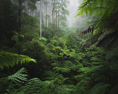
Los datos de pérdida de cobertura arbórea capturan las perturbaciones en la cobertura arbórea, definida aquí como vegetación leñosa con una altura de al menos 5 metros; obtenga más información sobre la cobertura arbórea en los términos y definiciones clave.
La pérdida de cobertura arbórea incluye las perturbaciones que despejan al menos la mitad de la cobertura arbórea dentro de un píxel de 30 metros y se detectan anualmente para cada año calendario. Solo se registra el primer año de pérdida que ocurre después del año 2000, lo que significa que si ocurren múltiples perturbaciones a lo largo del tiempo dentro del mismo píxel, solo se incluye el primer evento de perturbación.
Las perturbaciones incluyen la mortalidad o la remoción de árboles en bosques naturales, así como en plantaciones de fibra de madera o cultivos arbóreos, agrosilvicultura, parques urbanos u otras áreas con cobertura arbórea. La pérdida de la cubierta arbórea puede deberse a causas humanas, como la tala de árboles para la agricultura, la tala o la recolección de madera (las cuales pueden ser legales o ilegales) o a eventos naturales como tormentas, incendios forestales, deslizamientos de tierra, inundaciones o plagas de insectos. Estas pérdidas también pueden ser permanentes o temporales, lo que significa que los bosques pueden volver a crecer o recuperarse tras las perturbaciones.
Los datos sobre la pérdida de la cubierta arbórea pueden filtrarse mediante un conjunto de datos de referencia para centrarse en las pérdidas más preocupantes, como las zonas de bosque primario (véase más abajo).
¿En qué se diferencia la pérdida de cobertura arbórea de la deforestación?
La pérdida de cobertura arbórea no siempre equivale a deforestación, término que suele referirse a un cambio permanente, provocado por el ser humano, de un bosque a otro uso del suelo. Algunas formas de pérdida de cobertura arbórea provocadas por el ser humano, como la conversión de un bosque natural en tierra agrícola, se consideran generalmente como deforestación, mientras que otras, como la tala de madera en bosques de plantación o las perturbaciones naturales, a menudo no lo son; lee más sobre las diferencias en «términos clave y definiciones».
En algunos casos, como en el Rastreador de Metas de Deforestación y Restauración, utilizamos un indicador sustitutivo (proxy) de la deforestación. Ese indicador utiliza datos de sobre los factores que impulsan la pérdida de la cubierta arbórea e incluye toda la pérdida de la cubierta arbórea a nivel mundial derivada de la agricultura permanente, los productos básicos (minería o infraestructura energética) y la expansión de los asentamientos y la infraestructura, así como la pérdida de bosques primarios tropicales húmedos por el cultivo itinerante. No se incluyen las pérdidas temporales, como las causadas por incendios o actividades de tala.
¿Qué líneas de base utilizamos para medir la pérdida de cobertura arbórea?
Las estadísticas de pérdida de cobertura arbórea en todo el GFR (a menos que se indique lo contrario) y por defecto en Global Forest Watch, utilizan una línea de base de cobertura arbórea con una densidad de dosel superior al 30% en el año 2000. Esto significa que se incluye la pérdida dentro de esta zona de densidad de dosel del 30%, pero no se incluye la pérdida en densidades de dosel más bajas o en áreas que han vuelto a crecer desde el año 2000.
En Forest Pulse, nos centramos principalmente en la pérdida de bosque primario tropical porque los bosques tropicales sufren la gran mayoría (94%) de la deforestación mundial y la pérdida en esas áreas tiene un impacto enorme en la biodiversidad y el almacenamiento de carbono. Incluso si estas pérdidas se revierten eventualmente, tomará décadas para que estos hábitats y las reservas de carbono se recuperen además de que puede ocurrir una pérdida permanente de biodiversidad.
Para estos análisis, utilizamos como referencia los datos sobre la extensión de los bosques primarios tropicales húmedos de 2001 En este conjunto de datos, los bosques primarios se definen como bosques tropicales húmedos maduros que no han sido talados ni experimentado regeneración en la historia reciente; la pérdida de cobertura arbórea dentro de esta referencia excluye la pérdida en bosques secundarios jóvenes, plantaciones o cultivos arbóreos.
¿Qué incluye la pérdida de cobertura arbórea por incendios?
Informamos específicamente sobre la pérdida de cobertura arbórea debida a incendios porque estos suelen ser uno de los principales factores de pérdida a nivel mundial. Los datos sobre la pérdida de cobertura arbórea por incendios distinguen la pérdida provocada por incendios de todos los demás factores de pérdida para cada píxel de 30 metros de pérdida de cobertura arbórea mediante el uso de un modelo de aprendizaje automático para detectar árboles quemados.
Los datos recogen los incendios forestales naturales y los incendios provocados que resultan en la pérdida directa de la cubierta arbórea, incluidos los incendios descontrolados iniciados por el ser humano con fines relacionados con la agricultura, la caza, el ocio o el incendio intencional. Sin embargo, no se incluyen los casos en los que primero se talan los árboles y posteriormente se quema la vegetación residual, ya que el factor inicial de la pérdida es la remoción mecánica.
¿Cómo han mejorado los datos sobre la pérdida de la cubierta arbórea con el tiempo y cómo afecta esto a la comparabilidad entre años?
Los ajustes en los algoritmos y la mejora de los datos satelitales han mejorado el conjunto de datos sobre la pérdida de la cubierta arbórea con el tiempo. El algoritmo original se desarrolló para los años 2001-2012 y asignaba la pérdida a un solo año dentro de ese bloque de tiempo. Se desarrollaron mejoras posteriores para los siguientes períodos:
- 2013-2014 : Modelo de intervalo corto, añadiendo los años 2013 y 2014 mediante la evaluación de los cambios en un intervalo de 4 años.
- 2015-2017: Se incorporaron datos de Landsat 8; se aplicó el algoritmo de detección de cambios anuales utilizando modelos calibrados a nivel regional y local.
- 2018-2022: Se incorporó la Colección 2 de Datos Listos para el Análisis de Landsat (GLAD ARD), así como un algoritmo mejorado de detección de cambios utilizando modelos calibrados localmente.
- 2023-2024: Incorporación del conjunto de datos de perturbaciones terrestres DIST-ALERT para ayudar con los cambios de final de temporada.
En conjunto, estas mejoras han dado lugar a una mayor sensibilidad en la detección de cambios tales como la tala selectiva, el cultivo itinerante a pequeña escala y los incendios. La incorporación de DIST-ALERT también ha mejorado la detección de pérdidas de finales de temporada que, de otro modo, pasarían desapercibidas hasta el año siguiente debido a la limitación de los datos satelitales o a la cobertura nubosa. Además de los cambios metodológicos, las variaciones en la disponibilidad de imágenes satelitales (que en general ha aumentado con el tiempo) también implican que existen inconsistencias en la calidad y el número de imágenes disponibles para capturar datos cada año.
Para abordar estas inconsistencias, evaluamos el promedio móvil de tres años para interpretar las tendencias a largo plazo y también descartamos el aumento de la pérdida posterior a 2012 en lugares que probablemente se vean afectados por estos cambios, como África Central y Asia tropical.
¿Cómo se compara la pérdida de cobertura arbórea con otros tipos de sistemas de monitoreo?
Existen importantes diferencias definicionales y metodológicas entre los datos de pérdida de cobertura arbórea presentados en el GFR y los sistemas de monitoreo nacionales, como PRODES en Brasil y SIMONTANA en Indonesia. Estos conjuntos de datos tienen diferentes fortalezas y propósitos. Pueden presentar información complementaria que nos ayude a comprender mejor los diferentes tipos de cambios dentro de los bosques, pero es importante entender las diferencias antes de compararlos. Si bien no es una visión general completa, algunas diferencias comunes incluyen:
- Definiciones de «pérdida» y «línea de base para el monitoreo forestal»: . Mientras que los datos sobre la pérdida de cobertura arbórea incluyen la pérdida de cualquier tipo de cobertura arbórea por cualquier causa, los sistemas nacionales de monitoreo suelen ser más restrictivos en cuanto a los tipos de perturbaciones que incluyen en sus estadísticas y en la línea de base que utilizan para el monitoreo forestal, ya que su objetivo es medir la deforestación de acuerdo con definiciones oficiales. Por ejemplo, el PRODES de Brasil mide la deforestación por tala de bosques naturales para la agricultura, el pastoreo y la minería, pero no incluye la tala selectiva ni los incendios.
- Área mínima medida: Mientras que la pérdida de cobertura arbórea utiliza píxeles de 30 metros, los sistemas nacionales de monitoreo pueden utilizar una unidad de mapeo mínima más grande; por ejemplo, tanto PRODES como SIMONTANA utilizan una unidad de mapeo mínima de 6,25 hectáreas.
- Período de referencia: Si bien el período de referencia de los datos de pérdida de cobertura arbórea abarca el año calendario, tanto PRODES como SIMONTANA utilizan un período de referencia diferente: PRODES abarca de agosto a julio, mientras que SIMONTANA abarca de julio a junio.
- Métodos: Si bien varios sistemas de monitoreo pueden utilizar imágenes satelitales como datos de entrada, los métodos utilizados para detectar la pérdida pueden variar. Los datos sobre la pérdida de cobertura arbórea se producen utilizando un algoritmo automatizado para detectar la pérdida basado en imágenes satelitales de Landsat. Sin embargo, tanto PRODES como SIMONTANA utilizan la interpretación visual manual de imágenes satelitales para delimitar la pérdida.
Es importante tener en cuenta estas diferencias al interpretar las estadísticas entre los sistemas de monitoreo, ya que a menudo dan lugar a diferencias en la superficie de pérdida reportada anualmente por los distintos sistemas.
Lea nuestro blog sobre Global Forest Watch para obtener más información sobre los detalles y las diferencias específicas de los datos más recientes.
{"Glossary":{"141":{"name":"agroforestry","description":"A diversified set of agricultural or agropastoral production systems that integrate trees in the agricultural landscape.\r\n"},"101":{"name":"albedo","description":"The ability of surfaces to reflect sunlight.\u0026nbsp;Light-colored surfaces return a large part of the sunrays back to the atmosphere (high albedo). Dark surfaces absorb the rays from the sun (low albedo).\r\n"},"94":{"name":"biodiversity intactness","description":"The proportion and abundance of a location\u0027s original forest community (number of species and individuals) that remain.\u0026nbsp;\r\n"},"95":{"name":"biodiversity significance","description":"The importance of an area for the persistence of forest-dependent species based on range rarity.\r\n"},"142":{"name":"boundary plantings","description":"Trees planted along boundaries or property lines to mark them well.\r\n"},"98":{"name":"carbon dioxide equivalent (CO2e)","description":"Carbon dioxide equivalent (CO2e) is a measure used to aggregate emissions from various greenhouse gases (GHGs) on the basis of their 100-year global warming potentials by equating non-CO2 GHGs to the equivalent amount of CO2.\r\n"},"153":{"name":"climate domain","description":"Major ecosystem regions, summarized as boreal, temperate, tropical and subtropical.\u0026nbsp;"},"99":{"name":"CO2e","description":"Carbon dioxide equivalent (CO2e) is a measure used to aggregate emissions from various greenhouse gases (GHGs) on the basis of their 100-year global warming potentials by equating non-CO2 GHGs to the equivalent amount of CO2.\r\n"},"1":{"name":"deforestation","description":"The change from forest to another land cover or land use, such as forest to plantation or forest to urban area.\r\n"},"77":{"name":"deforested","description":"The change from forest to another land cover or land use, such as forest to plantation or forest to urban area.\r\n"},"76":{"name":"degradation","description":"The reduction in a forest\u2019s ability to perform ecosystem services, such as carbon storage and water regulation, due to natural and anthropogenic changes.\r\n"},"75":{"name":"degraded","description":"The reduction in a forest\u2019s ability to perform ecosystem services, such as carbon storage and water regulation, due to natural and anthropogenic changes.\r\n"},"79":{"name":"disturbances","description":"A discrete event that changes the structure of a forest ecosystem.\r\n"},"68":{"name":"disturbed","description":"A discrete event that changes the structure of a forest ecosystem.\r\n"},"65":{"name":"driver of tree cover loss","description":"The cause of tree cover loss, such as agriculture or urban development. There are direct drivers, which are the immediate cause of the loss, and indirect drivers, which are the secondary cause of loss (i.e., land speculation)."},"70":{"name":"drivers of loss","description":"The cause of tree cover loss, such as agriculture or urban development. There are direct drivers, which are the immediate cause of the loss, and indirect drivers, which are the secondary cause of loss (i.e., land speculation)."},"81":{"name":"drivers of tree cover loss","description":"The cause of tree cover loss, such as agriculture or urban development. There are direct drivers, which are the immediate cause of the loss, and indirect drivers, which are the secondary cause of loss (i.e., land speculation)."},"102":{"name":"evapotranspiration","description":"When solar energy hitting a forest converts liquid water into water vapor (carrying energy as latent heat) through evaporation and transpiration.\r\n"},"154":{"name":"fastwood monoculture","description":"Stands of single species planted trees that grow quickly.\u0026nbsp;"},"53":{"name":"forest degradation","description":"The reduction in a forest\u2019s quality and ability to perform ecosystem services, such as carbon storage and water regulation, due to natural and anthropogenic changes."},"54":{"name":"forest disturbance","description":"A discrete event that changes the structure of a forest ecosystem.\r\n"},"100":{"name":"forest disturbances","description":"A discrete event that changes the structure of a forest ecosystem.\r\n"},"5":{"name":"forest fragmentation","description":"The breaking of large, contiguous forests into smaller pieces, with other land cover types interspersed.\r\n"},"155":{"name":"Forest Landscape Restoration","description":"The ongoing process of restoring landscapes to regain ecological functionality and enhance human well-being across deforested or degraded forest landscapes."},"156":{"name":"forest moratorium","description":"A temporary restriction on activities that cause forest loss or degradation."},"69":{"name":"fragmentation","description":"The breaking of large, contiguous forests into smaller pieces, with other land cover types interspersed.\r\n"},"80":{"name":"fragmented","description":"The breaking of large, contiguous forests into smaller pieces, with other land cover types interspersed.\r\n"},"74":{"name":"gain","description":"The establishment of tree canopy in an area that previously had no tree cover. Tree cover gain may indicate a number of potential activities, including natural forest growth or the crop rotation cycle of tree plantations.\r\n"},"143":{"name":"global land squeeze","description":"Pressure on finite land resources to produce food, feed and fuel for a growing human population while also sustaining biodiversity and providing ecosystem services.\r\n"},"7":{"name":"hectare","description":"One hectare equals 100 square meters, 2.47 acres, or 0.01 square kilometers.\r\n"},"66":{"name":"hectares","description":"One hectare equals 100 square meters, 2.47 acres, or 0.01 square kilometers."},"67":{"name":"intact","description":"A forest that contains no signs of human activity or habitat fragmentation as determined by remote sensing images and is large enough to maintain all native biological biodiversity.\r\n"},"78":{"name":"intact forest","description":"A forest that contains no signs of human activity or habitat fragmentation as determined by remote sensing images and is large enough to maintain all native biological biodiversity.\r\n"},"8":{"name":"intact forests","description":"A forest that contains no signs of human activity or habitat fragmentation as determined by remote sensing images and is large enough to maintain all native biological biodiversity.\r\n"},"55":{"name":"land and environmental defenders","description":"People who peacefully promote and protect rights related to land and\/or the environment.\r\n"},"161":{"name":"logging concession","description":"A legal agreement allowing an entity the right to manage a public forest for production purposes, including for timber and other wood products."},"157":{"name":"logging concessions","description":"A legal agreement allowing an entity the right to manage a public forest for production purposes, including for timber and other wood products."},"160":{"name":"Logging concessions","description":"A legal agreement allowing an entity the right to manage a public forest for production purposes, including for timber and other wood products."},"9":{"name":"loss driver","description":"The cause of tree cover loss, such as agriculture or urban development. There are direct drivers, which are the immediate cause of the loss, and indirect drivers, which are the secondary cause of loss (i.e., land speculation).\r\n"},"10":{"name":"low tree canopy density","description":"Less than 30 percent tree canopy density.\r\n"},"104":{"name":"managed natural forests","description":"Naturally regenerated forests with signs of management, including logging and clear cuts.Lesiv et al. 2022, https:\/\/doi.org\/10.1038\/s41597-022-01332-3"},"91":{"name":"megacities","description":"A city with more than 10 million people.\r\n"},"57":{"name":"megacity","description":"A city with more than 10 million people."},"86":{"name":"natural","description":"A forest that that grows with limited or no human intervention. Natural forests can be managed or unmanaged (see separate definitions).\u0026nbsp;"},"12":{"name":"natural forest","description":"A forest that that grows with limited or no human intervention. Natural forests can be managed or unmanaged (see separate definitions). \r\n"},"63":{"name":"natural forests","description":"A forest that that grows with limited or no human intervention. Natural forests can be managed or unmanaged (see separate definitions).\u0026nbsp;"},"144":{"name":"open canopy systems","description":"Individual tree crowns that do not overlap to form a continuous canopy layer.\r\n"},"88":{"name":"planted","description":"Stands of trees established through planting, including both planted forest and tree crops."},"14":{"name":"planted forest","description":"Planted trees \u2014 other than tree crops \u2014 grown for wood and wood fiber production or for ecosystem protection against wind and\/or soil erosion.\r\n"},"73":{"name":"planted forests","description":"Planted trees \u2014 other than tree crops \u2014 grown for wood and wood fiber production or for ecosystem protection against wind and\/or soil erosion."},"148":{"name":"planted trees","description":"Stands of trees established through planting, including both planted forest and tree crops."},"149":{"name":"Planted trees","description":"Stands of trees established through planting, including both planted forest and tree crops."},"15":{"name":"primary forest","description":"Old-growth forests that are typically high in carbon stock and rich in biodiversity. The GFR uses a humid tropical primary rainforest data set, representing forests in the humid tropics that have not been cleared in recent years.\r\n"},"64":{"name":"primary forests","description":"Old-growth forests that are typically high in carbon stock and rich in biodiversity. The GFR uses a humid tropical primary rainforest data set, representing forests in the humid tropics that have not been cleared in recent years.\r\n"},"58":{"name":"production forest","description":"A forest where the primary management objective is to produce timber, pulp, fuelwood, and\/or nonwood forest products."},"89":{"name":"production forests","description":"A forest where the primary management objective is to produce timber, pulp, fuelwood, and\/or nonwood forest products.\r\n"},"159":{"name":"restoration","description":"Interventions that aim to improve ecological functionality and enhance human well-being in degraded landscapes. Landscapes may be forested or non-forested."},"87":{"name":"seminatural","description":"Forest with predominantly native trees that have not been planted. Trees are established through silvicultural practices, including natural regeneration or selective thinning.FAO"},"59":{"name":"seminatural forests","description":"Forest with predominantly native trees that have not been planted. Trees are established through silvicultural practices, including natural regeneration or selective thinning.FAO"},"96":{"name":"shifting agriculture","description":"Agricultural practices where forests are cleared, used for agricultural production for a few years, and then temporarily abandoned to allow trees to regrow and soil to recover.\u0026nbsp;"},"103":{"name":"surface roughness","description":"Surface roughness of forests creates\u0026nbsp;turbulence that slows near-surface winds and cools the land as it lifts heat from low-albedo leaves and moisture from evapotranspiration high into the atmosphere and slows otherwise-drying winds. \r\n"},"17":{"name":"tree cover","description":"All vegetation greater than five meters in height and may take the form of natural forests or plantations across a range of canopy densities. Unless otherwise specified, the GFR uses greater than 30 percent tree canopy density for calculations.\r\n"},"71":{"name":"tree cover canopy density is low","description":"The percent of ground area covered by the leafy tops of trees. tree cover: All vegetation greater than five meters in height and may take the form of natural forests or plantations across a range of canopy densities. Unless otherwise specified, the GFR uses greater than 30 percent tree canopy density for calculations.\u0026nbsp;\u0026nbsp;"},"60":{"name":"tree cover gain","description":"The establishment of tree canopy in an area that previously had no tree cover. Tree cover gain may indicate a number of potential activities, including natural forest growth or the crop rotation cycle of tree plantations.\u0026nbsp;As such, tree cover gain does not equate to restoration.\r\n"},"18":{"name":"tree cover loss","description":"The removal or mortality of tree cover, which can be due to a variety of factors, including mechanical harvesting, fire, disease, or storm damage. As such, loss does not equate to deforestation.\r\n"},"163":{"name":"tree cover loss due to fire","description":"The mortality of tree cover where forest fires were the direct cause of loss.\u0026nbsp;"},"164":{"name":"tree cover loss due to fires","description":"The mortality of tree cover where forest fires were the direct cause of loss.\u0026nbsp;"},"162":{"name":"tree cover loss from fires","description":"The mortality of tree cover where forest fires were the direct cause of loss.\u0026nbsp;"},"150":{"name":"tree crops","description":"Stand of perennial trees that produce agricultural products, such as rubber, oil palm, coffee, coconut, cocoa and orchards."},"85":{"name":"trees outside forests","description":"Trees found in urban areas, alongside roads, or within agricultural land\u0026nbsp;are often referred to as Trees Outside Forests (TOF).\u202f\r\n"},"151":{"name":"unmanaged","description":"A forest that grows without human intervention and has no signs of management, including primary forest.Lesiv et al. 2022, https:\/\/doi.org\/10.1038\/s41597-022-01332-3"},"105":{"name":"unmanaged natural forests","description":"A forest that grows without human intervention and has no signs of management, including primary forest.Lesiv et al. 2022, https:\/\/doi.org\/10.1038\/s41597-022-01332-3"},"158":{"name":"tree cover loss from fire","description":"The mortality of tree cover where forest fires were the direct cause of loss.\u0026nbsp;"}}}